Watchin' the drought spread
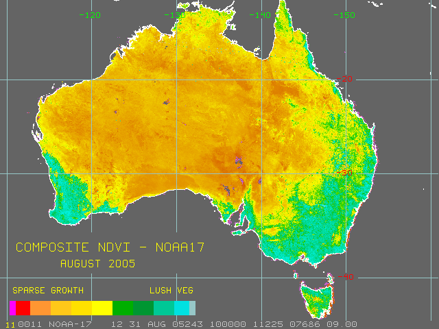
This drought movie shows how the drought has spread over the last 12 months. The link will take you to the Bureau of Meteorology's NDVI map viewer. These are satellite photos taken by the NOAA-17 satellite and they've been color coded to show vegetation growth. It takes a little while to load but you can really see the way in which the winter rain has failed across southern australia. If you want to make your own movie then go here..
posted by Kyan gadac at 4:33 pm
![]()

0 Comments:
Post a Comment
<< Home